- About Us
- Publications
- ADPC Academy
-
MediaADPC'S NEWS
Earthquake risk and safer urban planning: A step towards building better Earthquake risk and safer urban planning: A step towards building better
19 Oct 2015
Mymensingh, Bangladesh
With a population of more than 160 million, Bangladesh has suffered from floods and cyclones more than any other country in Asia. Half a million people died in a cyclone in 1970. Another deadly cyclone hit the country in 1991 killing about 150,000 people. Cyclone Sidr in 2007 destroyed 45,000 houses across 30 districts and affected a total of 2.3 million households. In regard to seismic events, fortunately, only localized tremors have been felt, and the country has not experienced a major earthquake within the past century.
There are growing concerns, however, as scientists discovered an active fault line beneath the Haluaghat sub-district of Mymensingh after an earthquake jolted Dhaka in September 2011. Experts fear that a high-intensity earthquake could produce an unprecedented tragedy due to high population density, poor construction practices, and unregulated rapid urbanization in Bangladesh.
Mymensingh is one the oldest districts of Bangladesh with an estimated population of 500,000. The city of Mymensingh is one of the many rapidly growing and densely populated secondary towns in the country, at risk to a range of hazards including urban flooding, earthquake, and fire.
Use of the Global Positioning System (GPS) allows the survey team to provide a precise spatial representation of actual features
on the map in a geographic information system.
Mymensingh Strategic Development Plan and public participation
Urban planners in Bangladesh develop master plans, which are intended to guide urban growth in a sustainable way, and one critical component of master planning relies on consultations with the public. In Mymensingh, officials conducted a rapid appraisal intended to seek inputs from the public for preparing and implementing the Mymensingh Strategic Development Plan. This is believed to be an important plan, which will develop all the potential areas of the city over the next 20 years. The appraisal noted that most of the issues important from an urban planning perspective attracted little or no attention at all.
Dr. Khurshid Zabin Hossain Taufique, Project Director of the Mymensingh Strategic Development Plan at the Urban Development Directorate, recognizes that most of the people are unaware of the earthquake risk and the severe impact that a major seismic event could afflict on their lives.
“This is largely because they do not have a recent history of earthquakes. People think they have more pressing problems to deal with than to worry about something that might or might not happen in their lifetime,” explains Dr. Taufique. The government, he says, is mindful of people’s perception and is doing its best to create an environment as well as instruments to guide the residents of Mymensingh to build their physical structures better right from the beginning.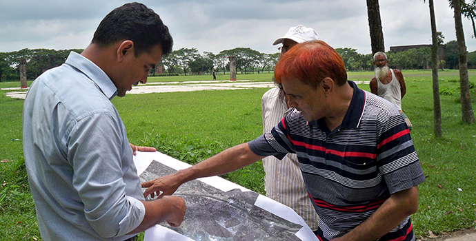
A team of experts is discussing data gaps during the field verification process.
“We are integrating disaster risk reduction measures into the land-use planning of the Mymensingh Strategic Development Plan with technical support from Asian Disaster Preparedness Center. This is done within the framework of the Comprehensive Disaster Management Programme-II of the Ministry of Disaster Management and Relief,” tells Dr. Taufique while sharing details of the Urban Development Directorate’s risk-resilient development agenda.
Understanding the threat
The recent 7.8-magnitude earthquake in Nepal that took more than 3000 lives also jolted parts of Bangladesh. However, it did little to jolting the public view in the country about the consequences that poor and faulty development practices could have in earthquake-prone areas.
Dr. Taufique thinks that in an environment of public apathy towards serious threats emanating from a natural phenomenon, the government has to step up its efforts for mitigating disaster risk by enforcing rules and regulations for land-use planning and management.
The first step in this direction is to carry out a detailed assessment of existing risks and vulnerabilities of a particular geographical area, as technical data and information lay the foundations for land-use planning. ADPC aided the Urban Development Directorate in carrying out a risk assessment in Mymensingh city and, based on this information, helped the Directorate in preparing a module to mainstream disaster risk reduction measures into comprehensive land-use development planning.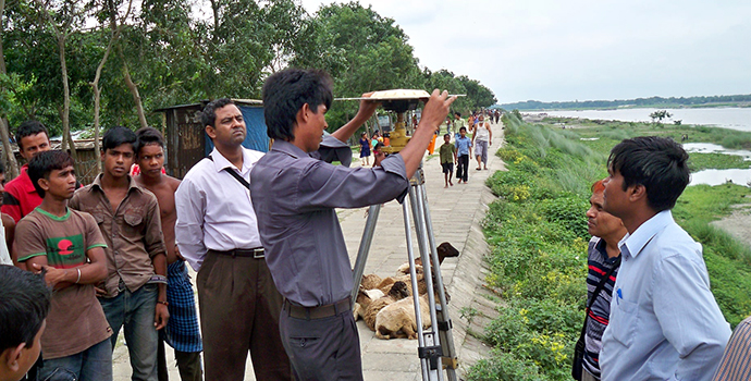
The project team uses land-surveying tools to determine measurements and accurate local conditions. This information is then
recorded on the field and uploaded into a geographic information system for further analysis.
Besides other information, the assessment identified fragile residential buildings, unsafe nonresidential areas, as well as projected losses of lives and damage to property should an earthquake of a certain magnitude hit Mymensingh. This information is not only helpful for the Urban Development Directorate’s planners but also private sector investors, along with other government departments, can make good use of it in sectoral development, contingency planning, and emergency response management, especially for fire incidents.
In a worst-case scenario, of the more than 45,000 buildings in the municipality, about 22,000 may be damaged beyond repair and a lot more can suffer moderate losses. Since 82 percent of all buildings are used for residential purposes, the risk for losses of lives in a potential earthquake is very high. This information was recorded using a geographic information system and all the data is available online at www.msdp.gov.bd.
Collaboration to build better
Lack or absence of risk information is one of the major reasons for land-use plans to be ineffective in bringing long-term development gains to citizens. Similarly, there is a need to raise officials’ awareness of disaster risk management concepts along with the availability of risk information for urban planning. Improving awareness and local planning capacity are two important factors that can create an enabling environment for safer use of land for development in Bangladesh.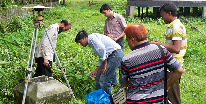
In the future, development plans in Mymensingh will be based on critical risk information about earthquake hazards.
ADPC’s and the Urban Development Directorate’s joint initiative has addressed these fundamental issues of integrating risk information into the urban planning process in Mymensingh. The Directorate is now using risk information for land-use planning and the management of the Mymensingh Strategic Development Plan, which means that development will be based on critical risk information about earthquake hazards.
The government is planning to take further steps to ensure that both public and private sectors opt for building infrastructure and housing better right from the outset. The Urban Development Directorate will develop guidelines to be referred to for clearance of future land use and building construction permits. The approving authorities will be trained to use these guidelines for issuing occupancy certificates in addition to clearing other related conditions.
“The project and its outputs have greatly helped the directorate in defining its future course of action for facilitating and promoting disaster-resilient development, which will go beyond Mymensingh,” Dr. Taufique concludes confidently.
–––––––––––––––––––––––––––––––––––––––––––––––––––––––––––––––––––––––––––––––––––––––––––––––––––––––
Geographic information systems
Understanding the geography of communities, towns and cities is essential for making informed planning decisions. A geographic information system, or GIS, is a tool used to understand geography and to store critical information about multiple features related to infrastructure. All this information can be displayed on a computer screen or a map.
GIS programs can show the relationships between different features on the map and they are capable of providing a very detailed analysis. In the case of seismic risk assessments, earthquake risk information is combined with buildings, roads and other assets to determine the overall risk to each feature.
In recent years, geographic information systems have become more accessible in countries like Bangladesh, and they are valuable in local urban planning initiatives.
–––––––––––––––––––––––––––––––––––––––––––––––––––––––––––––––––––––––––––––––––––––––––––––––––––––––
Participatory approach to development
The Urban Development Directorate has adopted the participatory rapid appraisal tool as a means to promote public participation and integrating inputs from the public into the land-use planning process. It has organized 39 pre-planning sessions with urban and rural project communities to get a complete picture of the areas including their development problems and suggestive solutions.
–––––––––––––––––––––––––––––––––––––––––––––––––––––––––––––––––––––––––––––––––––––––––––––––––––––––
By: Vidya Rana and Matthew Sarsycki (matthew.s@adpc.net)
Download the Impact Story (pdf).
-