- About Us
- Publications
- ADPC Academy
-
MediaADPC'S NEWS
USAID, NASA and ADPC officially launch SERVIR-Mekong USAID, NASA and ADPC officially launch SERVIR-Mekong
1 Sep 2015
Bangkok, Thailand
The formal launch of the geospatial data for development program SERVIR-Mekong took place on 31 August 2015 at Asian Disaster Preparedness Center’s headquarters in Bangkok. The project promotes the use of satellite imagery to help Asia’s Lower Mekong region better predict and cope with floods and other natural disasters and increase resilience to the negative effects of climate change.
SERVIR-Mekong, funded by the United States Agency for International Development (USAID) and the U.S. National Aeronautics and Space Administration (NASA), and implemented by ADPC and its partners, will help governments and other decision-makers in Myanmar (Burma), Cambodia, Lao PDR, Thailand and Vietnam take advantage of publicly available satellite imagery, geospatial data, and maps to make more informed decisions on critical issues such as water management, land use planning, disaster risk reduction, infrastructure development and natural resources management.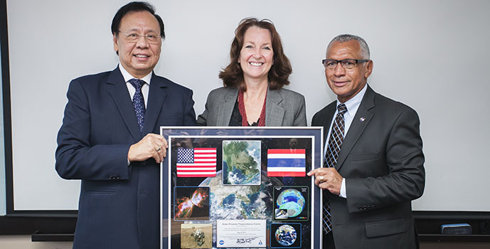
Beth Paige, director of USAID’s Regional Development Mission for Asia (in the middle) with NASA Administrator Charles Bolden
(right) and ADPC's Special Advisor Dr. Bhichit Rattakul (left) at the launch event of SERVIR-Mekong.
"It's an honor to welcome into the SERVIR community one of the most exciting, progressive, vital regions of the planet," said NASA Administrator Charles Bolden, who took part in the facility's official opening.
"Today NASA demonstrates the human impact of its science mission here on Earth, and our commitment to protecting the resources, the environment and most of all the millions of people living, working and raising new generations of pioneers and innovators across the region," Bolden said.
“Under SERVIR-Mekong, we are tapping into the best available science and technology to help protect this region’s vital ecosystems and the benefits they provide to society,” said Beth Paige, director of USAID’s Regional Development Mission for Asia. “Already, Asian scientists, NASA scientists and others are beginning to develop tools to build resilience and contribute to tackling some of the region's most pressing challenges.”
An open call for proposals
SERVIR-Mekong promotes collaboration between technical institutions in the region and develops analytical tools. SERVIR-Mekong is about to launch a call for proposals from environmental planning agencies and other institutions seeking technical support to better inform development decisions.
“The ‘open call’ is a system that allows anyone to make a request to SERVIR, to participate and share their ideas,” said Dr. Peeranan Towashiraporn, SERVIR-Mekong Deputy Chief of Party and ADPC Director.
SERVIR-Mekong and its partners are also developing a mapping tool so that anyone with internet access can view the extent of flooding in real time. This tool and others will be available on the SERVIR-Mekong portal at servir.adpc.net.
SERVIR-Mekong is one of three regional SERVIR hubs around the world.
For more photos and video clips from the launch events, visit here.
Further reading:
The Straits Times: Nasa satellite data now freely available to public
The Bangkok Post: Nasa grants access to climate data trove
More photos are available on ADPC's Flickr.
-